|
|
Loading...
Searching...
No Matches
|
|
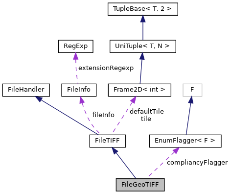
#include <FileGeoTIFF.h>
Public Types | |
| enum | TiffCompliance { UNDEFINED =0 , TIFF =1 , GEOTIFF =2 , EPSG =6 , STRICT =10 } |
| Require strict GeoTIFF compliance. More... | |
| typedef drain::EnumFlagger< drain::MultiFlagger< TiffCompliance > > | complianceFlagger |
 Public Types inherited from FileTIFF Public Types inherited from FileTIFF | |
| typedef drain::SingleFlagger< unsignedint >::dict_t | dict_t |
Public Member Functions | |
| FileGeoTIFF (const std::string &path, const std::string &mode="w") | |
| virtual void | open (const std::string &path, const std::string &mode="w") |
| Opens a GeoTIFF file. | |
| template<typename T > | |
| void | setGeoTiffField (geokey_t tag, T value) |
| void | writeMetadata () |
| Completes GeoTIFF structure. | |
| virtual void | close () |
| virtual bool | isOpen () const |
| Todo: subclass. | |
| void | setGdalScale (double scale=1.0, double offset=0.0) |
| void | setGdalNoData (const std::string &nodata) |
| This is between Tiff and GeoTiff? | |
| template<class T > | |
| void | setGdal (const std::string &key, const T &value, int sample=-1, const std::string &role="") |
| void | setGeoMetaData (const drain::image::GeoFrame &frame) |
| Sets projection and bounding box. Adjusts spatial resolution accordingly. | |
| bool | setProjectionEPSG (short epsg) |
| Set projection using EPSG code. This is the recommended way. | |
| void | setProjection (const std::string &proj) |
| Sets projection given in Proj.4 string format. | |
| void | setProjection (const drain::Proj6 &proj) |
| Sets projection, primarily using EPSG if found, else Proj.4 string format. | |
| void | setProjectionLongLat () |
| Sets projection to plain longitude-latitude mapping. | |
| template<> | |
| void | setGeoTiffField (geokey_t tag, const char *value) |
| template<> | |
| void | setGeoTiffField (geokey_t tag, const std::string &value) |
| Public Member Functions inherited from FileTIFF | |
| FileTIFF (const std::string &path="", const std::string &mode="w") | |
| int | setField (int tag, const std::string &value) |
| template<class T > | |
| int | setField (int tag, const std::vector< T > &value) |
| template<class T > | |
| int | setField (int tag, T value) |
| void | useDefaultTileSize () |
| void | setTileSize (int tileWidth, int tileHeight=0) |
| void | setTime (const drain::Time &time) |
| void | setDefaults () |
| void | writeImageData (const drain::image::Image &src) |
Public Attributes | |
| TreeGDAL | gdalMetadata |
| Use EPSG specific support only, if found. Else use also fromProj4Str(). | |
Static Public Attributes | |
| static complianceFlagger | compliancyFlagger |
| static std::string | compliancy |
| Static Public Attributes inherited from FileTIFF | |
| static const drain::FileInfo | fileInfo |
| static const dict_t | compressionDict |
| static dict_t::value_t | defaultCompression |
| static drain::Frame2D< int > | defaultTile |
Protected Attributes | |
| GTIF * | gtif |
| Protected Attributes inherited from FileTIFF | |
| TIFF * | tif |
| drain::Frame2D< int > | tile |
Additional Inherited Members | |
| Static Public Member Functions inherited from FileTIFF | |
| static void | write (const std::string &path, const drain::image::Image &src) |
| Default implementation. | |
Extends TIFF by adding geo information in the metadata
| enum TiffCompliance |
Require strict GeoTIFF compliance.
TODO: consider TIFF,default,GTIFF,StrictGTIFF
|
virtual |
Reimplemented from FileTIFF.
|
inlinevirtual |
Todo: subclass.
Reimplemented from FileTIFF.
|
virtual |
Opens a GeoTIFF file.
Reimplemented from FileTIFF.
| void setGdalNoData | ( | const std::string & | nodata | ) |
This is between Tiff and GeoTiff?
| nodata | - yes, string... |
| void setGdalScale | ( | double | scale = 1.0, |
| double | offset = 0.0 |
||
| ) |
| nodata | - yes, string... |
| void setProjection | ( | const std::string & | proj | ) |
Sets projection given in Proj.4 string format.
If EPSG is detected (currently by +init=epsg:EPSG) and support configured for EPSG code, set it directly.
| bool setProjectionEPSG | ( | short | epsg | ) |
Set projection using EPSG code. This is the recommended way.
See also:
gdalsrsinfo EPSG:5130 | fgrep 'CRS['
| void writeMetadata | ( | ) |
Completes GeoTIFF structure.
"Opens" a GeoTIFF structure inside an opened TIFF file.
 1.9.8
1.9.8